Geospatial Technology & Data Science
Apply for AdmissionWhy Study Geospatial Technology & Data Science
Geographic Information Systems (GIS) is a technology that uses maps and data to help people understand patterns and relationships in the world around them. Often described as a “smart map,” GIS can display, store, and analyze geographic information to support better decision-making. It is part of the broader field of geospatial technology, which also includes tools such as GPS and remote sensing.
Geospatial technology is one of the top emerging industries of the 21st century, according to the U.S. Department of Labor. Many tools you use every day—like navigation apps such as Google Maps and Waze—rely on GIS to organize and display location-based data.
GIS is used across many industries and academic fields, including urban planning, environmental science, agriculture, archaeology, public safety, business analytics, and engineering. As organizations increasingly rely on geographic data, GIS skills are becoming valuable in a wide range of careers.
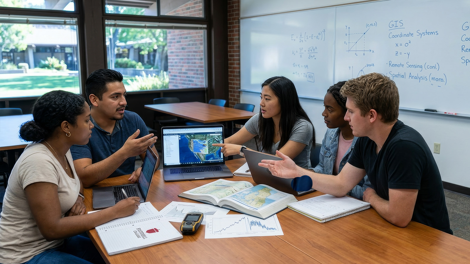
Why Study GIS at Foothill?
Foothill College’s Geographic Information Systems program emphasizes practical, hands-on learning. You gain experience working with real data and industry-standard tools such as ArcGIS Online, ArcGIS Pro, and QGIS, while learning how to design and manage GIS projects.
The program provides broad technical exposure rather than focusing on a single software platform, helping you apply geospatial analysis to many different fields. Courses follow curriculum guidelines developed by the National Science Foundation (NSF) and the National Center for Geographic Information Analysis (NCGIA), preparing you with skills used by professionals in the growing geospatial industry.
Complete your class labs with industry standard software ArcGIS Pro and QGIS using
our virtual desktop server.
GIS Labs Now Offered Entirely Online
What can you do with a degree in Geographic Information Systems?

A major in Geospatial Information Systems can prepare you for:
- Archaeologist
- Cartographer
- City manager
- Geographer
- GIS technician
- Mapping Technician
- Surveyor
At a Glance
- Archaeologists, architects, engineers, police and fire fighters, marketing and business, surveyors, data scientist, biologists and earth scientists all use geospatial technology.
- Increasingly, public works employees need some knowledge of geospatial technology for their work.
- A certificate or degree in geospatial technology can boost your earning potential and increase employability.
- Foothill College offers evening and online classes to accommodate your schedule.
The faculty in the department of Geography & Geospatial Technology promote a classroom environment of equity and inclusion. We are committed to teaching through an antiracist lens that empowers students to explore and analyze the underlying causes of racial injustice in our world and take action for equity and positive change. We are committed to providing our students a learning experience free of racism, sexism, and other forms of bigotry while maintaining open lines of communication that provide a safe space for students to seek support.
The fields of Geography and Geospatial Technology provide data-driven evidence of racial and socioeconomic disparities through maps. These maps can be used as vehicles to drive change through shared information. Geography can be used to examine the cultural, historic, and physical characteristics of divisions in our society and strives for equity through understanding and addressing the underlying causes of these divisions. Geospatial Technology is a suite of tools that empowers people to examine and share, via multimedia, patterns of inequity and advocate for change.
The faculty and students of Geography and Geospatial Technology programs include diverse racial and ethnic identities, nationalities, immigration status, gender expressions, socio-economic backgrounds, religions, ages, and health conditions. Our students come from various life experiences and have different needs. The department faculty strive to include diverse voices and perspectives and provide every student with the resources, guidance, and support that they need to ensure their success not only in the classroom but in the world beyond.
More Resources
Degrees & Certificates
View list below for programs offered at Foothill. Then select program map for a possible schedule that fulfills program and college requirements.
For program requirements and full course listings, view degrees and certificates information.
Ways to Experience More!
At Foothill, we offer many opportunities to get involved outside the classroom.

Gain real-world experience through paid internships with mission-driven nonprofit organizations. Build professional skills, connect coursework to careers, and work with community partners across the region.

Travel, study, and gain real-world experience through Foothill’s faculty-led global programs. Explore new cultures, earn academic credit, and participate in service learning, research, and study abroad around the world.

Showcase your ideas and creativity at Foothill’s annual symposium, where students present research, service projects, and creative work through talks, posters, performances, and art exhibitions.
Related Programs and Degrees